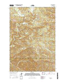
2017 Map of Elsie
USGS Topo · Published 2017About this map
The Nehalem River winds through the forested highlands of the Coast Range, anchoring a landscape defined by timber access and rugged drainages. Near the settlement of Elsie, the terrain is marked by family-named infrastructure like Joe Woodard Rd and Luukinen Loop Rd, alongside the historic Sunny Hill Cem overlooking the Nehalem Valley. The map reveals a complex network of fire roads and logging mains, including the August Fire Rd and Quartz Creek Mainline, which navigate the steep rises toward Flat Iron Mtn and Four Seven Ridge. This 2017 survey details the numerous tributaries feeding the river system, from Spruce Run Cr to the N Fork Salmonberry River, illustrating how topography dictates the movement of both water and commerce in this remote corner of Oregon.
Find a feature on this map
65 named features on this map. Tap any name to fly to it.
Don’t see what you’re looking for? This feature index may not catch every label — zoom into the map to look around manually.
Map Details
Editions of this 2017 Elsie Map
This is the sole edition of this map. No revisions or reprints were ever made.
Other maps of this area

1937 · Enright
USGS Topo · 1:62,500

1939 · Saddle Mountain
USGS Topo · 1:62,500

1941 · Keasey
USGS Topo · 1:62,500

1941 · Timber
USGS Topo · 1:62,500

1941 · Enright
USGS Topo · 1:62,500

1943 · Keasey
USGS Topo · 1:62,500

1943 · Saddle Mtn.
USGS Topo · 1:62,500

1948 · Vancouver
USGS Topo · 1:250,000

1950 · Vancouver
USGS Topo · 1:250,000

1950 · Vancouver
USGS Topo · 1:250,000