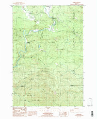
1984 Map of Elsie
USGS Topo · Published 1984About this map
The Nehalem River winds through the heart of this coastal timberland, carving a deep valley through the Clatsop State Forest and northern Tillamook State Forest. At the time of this mid-1980s provisional survey, the settlement of Elsie and nearby Jewell Junction served as primary hubs along the river, while smaller points like Lukarilla and Pope Corner marked the intersections of local logging roads and creek drainages.
Find a feature on this map
40 named features on this map. Tap any name to fly to it.
Don’t see what you’re looking for? This feature index may not catch every label — zoom into the map to look around manually.
Map Details
Editions of this 1984 Elsie Map
This is the sole edition of this map. No revisions or reprints were ever made.
Other maps of this area

1937 · Enright
USGS Topo · 1:62,500

1939 · Saddle Mountain
USGS Topo · 1:62,500

1941 · Keasey
USGS Topo · 1:62,500

1941 · Timber
USGS Topo · 1:62,500

1941 · Enright
USGS Topo · 1:62,500

1943 · Keasey
USGS Topo · 1:62,500

1943 · Saddle Mtn.
USGS Topo · 1:62,500

1948 · Vancouver
USGS Topo · 1:250,000

1950 · Vancouver
USGS Topo · 1:250,000

1950 · Vancouver
USGS Topo · 1:250,000