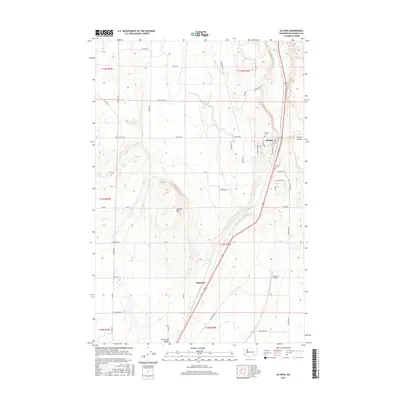
2017 Map of Eltopia
USGS Topo · Published 2017About this map
Eltopia and the surrounding farmland of southern Franklin County are defined by the grid-like organization of the Columbia Basin's agricultural landscape. The settlement of Eltopia serves as a central point, with local landmarks such as Eltopia Cem and a network of named roads like Seattle Ave and Tacoma Ave reflecting its local community structure. The topography is shaped by the presence of Jackass Mtn to the west and Smith Canyon to the east, while the Esquatzel Coulee cuts through the southern reaches of the map near Sagemoor. This era of the landscape is characterized by a mix of intensive irrigation, transportation corridors like Highway 395, and small-scale aviation at Pfister's Airport.
Find a feature on this map
49 named features on this map. Tap any name to fly to it.
Don’t see what you’re looking for? This feature index may not catch every label — zoom into the map to look around manually.
Map Details
Editions of this 2017 Eltopia Map
This is the sole edition of this map. No revisions or reprints were ever made.
Other maps of this area

1915 · Wallulah
USGS Topo · 1:96,000

1916 · Connell
USGS Topo · 1:125,000

1917 · Pasco
USGS Topo · 1:125,000

1918 · Connell
USGS Topo · 1:125,000

1918 · Wallula
USGS Topo · 1:125,000

1925 · Scooteney Lake
USGS Topo · 1:62,500

1951 · Scooteney Lake
USGS Topo · 1:62,500

1953 · Walla Walla
USGS Topo · 1:250,000

1958 · Walla Walla
USGS Topo · 1:250,000

1963 · Rye Grass Coulee
USGS Topo · 1:24,000