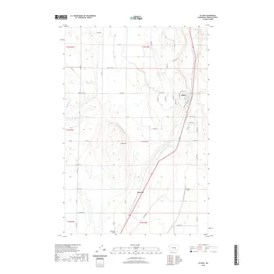
2020 Map of Eltopia
USGS Topo · Published 2020About this map
The settlement of Eltopia serves as the focal point of this Franklin County landscape, situated at the edge of the irrigated plains of eastern Washington. The town layout is defined by a grid including School Rd and Seattle Ave, with the Eltopia Cem positioned just to the north. This 2020 map documents a region where agricultural water infrastructure and natural geological features meet, most notably where the Potholes Canal winds through the northwestern hills and Esquatzel Coulee cuts across the southern terrain. South of the primary settlement, the locality of Sagemoor sits near the small private airstrip known as Pfister's Airport. Dominating the central topography is Jackass Mtn, a prominent landform that rises above the surrounding network of rural routes like N Glade Rd and Hooper Rd.
Find a feature on this map
49 named features on this map. Tap any name to fly to it.
Don’t see what you’re looking for? This feature index may not catch every label — zoom into the map to look around manually.
Map Details
Editions of this 2020 Eltopia Map
This is the sole edition of this map. No revisions or reprints were ever made.
Other maps of this area

1915 · Wallulah
USGS Topo · 1:96,000

1916 · Connell
USGS Topo · 1:125,000

1917 · Pasco
USGS Topo · 1:125,000

1918 · Connell
USGS Topo · 1:125,000

1918 · Wallula
USGS Topo · 1:125,000

1925 · Scooteney Lake
USGS Topo · 1:62,500

1951 · Scooteney Lake
USGS Topo · 1:62,500

1953 · Walla Walla
USGS Topo · 1:250,000

1958 · Walla Walla
USGS Topo · 1:250,000

1963 · Rye Grass Coulee
USGS Topo · 1:24,000