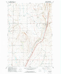
1992 Map of Eltopia
USGS Topo · Published 1992About this map
The Esquatzel Coulee forms the geographic spine of this Franklin County landscape, where the Burlington Northern railroad corridor parallels the valley floor. Near the northern end of the coulee sits the settlement of Eltopia, a community defined by its proximity to the rail line and a network of agricultural infrastructure. The map reveals a complex system of water management essential to the region's development, including the Eltopia Branch, several segments of Canal, and multiple installations of Aqueduct and Siphon technology.
Find a feature on this map
37 named features on this map. Tap any name to fly to it.
Don’t see what you’re looking for? This feature index may not catch every label — zoom into the map to look around manually.
Map Details
Editions of this 1992 Eltopia Map
This is the sole edition of this map. No revisions or reprints were ever made.
Other maps of this area

1915 · Wallulah
USGS Topo · 1:96,000

1916 · Connell
USGS Topo · 1:125,000

1917 · Pasco
USGS Topo · 1:125,000

1918 · Connell
USGS Topo · 1:125,000

1918 · Wallula
USGS Topo · 1:125,000

1925 · Scooteney Lake
USGS Topo · 1:62,500

1951 · Scooteney Lake
USGS Topo · 1:62,500

1953 · Walla Walla
USGS Topo · 1:250,000

1958 · Walla Walla
USGS Topo · 1:250,000

1963 · Rye Grass Coulee
USGS Topo · 1:24,000