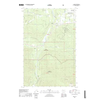
2020 Map of Elwha
USGS Topo · Published 2020About this map
Elwha and the western outskirts of Port Angeles dominate this map of the northern Olympic Peninsula. The Elwha River cuts a deep path northward, crossed by the Elwha River Bridge and flanked by industrial and recreational access points. To the east, the William R Fairchild International Airport marks the transition into the city's suburban fringe, while the community of Braeburn sits near a dense network of timber and access roads such as the Main Access Road and Staging Access Road.
Find a feature on this map
102 named features on this map. Tap any name to fly to it.
Don’t see what you’re looking for? This feature index may not catch every label — zoom into the map to look around manually.
Map Details
Editions of this 2020 Elwha Map
This is the sole edition of this map. No revisions or reprints were ever made.
Other maps of this area

1918 · Port Angeles
USGS Topo · 1:62,500

1919 · Port Crescent
USGS Topo · 1:62,500

1935 · Mount Olympus
USGS Topo · 1:62,500

1938 · Mt Constance
USGS Topo · 1:125,000

1941 · Port Angeles
USGS Topo · 1:62,500

1942 · Mount Olympus
USGS Topo · 1:62,500

1944 · Mt. Angeles
USGS Topo · 1:62,500

1946 · Mt. Angeles
USGS Topo · 1:62,500

1950 · Elwha
USGS Topo · 1:24,000

1950 · Ediz Hook
USGS Topo · 1:24,000