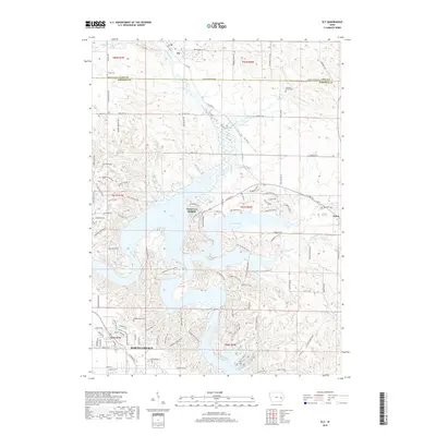
2018 Map of Ely
USGS Topo · Published 2018About this map
The Iowa River and the expansive Lake McBride dominate the central landscape of this Johnson County region, illustrating a geography defined by post-war water management and recreational development. Residential growth is centered around the established communities of North Liberty, Ely, and Solon, while Twin View Heights occupies a prominent position overlooking the reservoir. This modern survey captures the transition of the area from traditional rural farmsteads to a popular residential and outdoor destination.
Find a feature on this map
114 named features on this map. Tap any name to fly to it.
Don’t see what you’re looking for? This feature index may not catch every label — zoom into the map to look around manually.
Map Details
Editions of this 2018 Ely Map
This is the sole edition of this map. No revisions or reprints were ever made.
Other maps of this area

1887 · Cedar Rapids
USGS Topo · 1:62,500

1891 · Mechanicsville
USGS Topo · 1:62,500

1891 · Cedar Rapids
USGS Topo · 1:62,500

1891 · Iowa City
USGS Topo · 1:62,500

1894 · Mechanicsville
USGS Topo · 1:62,500

1894 · West Liberty
USGS Topo · 1:62,500

1901 · Stanwood
USGS Topo · 1:125,000

1903 · Fairfax
USGS Topo · 1:125,000

1938 · Iowa City
USGS Topo · 1:62,500

1958 · Davenport
USGS Topo · 1:250,000