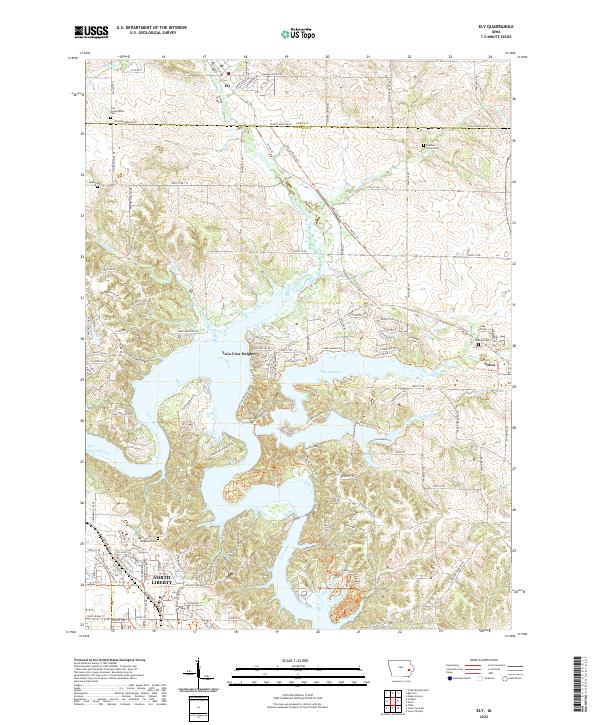
2022 Map of Ely
USGS Topo · Published 2022About this map
Lake McBride dominates the center of this landscape, its sprawling waters and irregular shoreline defining the geography between the growing communities of Solon and North Liberty. The Iowa River flows through the southwestern portion of the sheet, while the Hoover Nature Trl follows a linear path across the terrain, reflecting the conversion of former rail corridors into modern recreational space. This 2022 survey captures a mix of residential expansion and preserved agricultural history, with the city of Ely situated at the northern edge.
Find a feature on this map
130 named features on this map. Tap any name to fly to it.
Don’t see what you’re looking for? This feature index may not catch every label — zoom into the map to look around manually.
Map Details
Editions of this 2022 Ely Map
This is the sole edition of this map. No revisions or reprints were ever made.
Other maps of this area

1887 · Cedar Rapids
USGS Topo · 1:62,500

1891 · Mechanicsville
USGS Topo · 1:62,500

1891 · Cedar Rapids
USGS Topo · 1:62,500

1891 · Iowa City
USGS Topo · 1:62,500

1894 · Mechanicsville
USGS Topo · 1:62,500

1894 · West Liberty
USGS Topo · 1:62,500

1901 · Stanwood
USGS Topo · 1:125,000

1903 · Fairfax
USGS Topo · 1:125,000

1938 · Iowa City
USGS Topo · 1:62,500

1958 · Davenport
USGS Topo · 1:250,000