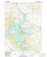
1994 Map of Ely
USGS Topo · Published 1994About this map
Coralville Lake and Lake Macbride dominate this 1994 map of the boundary between Linn Co and Johnson Co. The landscape is a mix of sprawling reservoirs and agricultural uplands, with the Iowa River flowing through the southern reach. Local history and recreation are centered around Lake Macbride State Park, where campgrounds and picnic areas line the water near the Twin View Heights settlement. In the north, Ely marks the upper survey limit, while an Old Railroad Grade provides evidence of former transit routes cutting through the terrain towards Solon. For researchers, the presence of small local cemeteries like Sulek Cem and Oakland Cem offers valuable markers for family history near the water's edge.
Find a feature on this map
27 named features on this map. Tap any name to fly to it.
Don’t see what you’re looking for? This feature index may not catch every label — zoom into the map to look around manually.
Map Details
Editions of this 1994 Ely Map
This is the sole edition of this map. No revisions or reprints were ever made.
Other maps of this area

1887 · Cedar Rapids
USGS Topo · 1:62,500

1891 · Mechanicsville
USGS Topo · 1:62,500

1891 · Cedar Rapids
USGS Topo · 1:62,500

1891 · Iowa City
USGS Topo · 1:62,500

1894 · Mechanicsville
USGS Topo · 1:62,500

1894 · West Liberty
USGS Topo · 1:62,500

1901 · Stanwood
USGS Topo · 1:125,000

1903 · Fairfax
USGS Topo · 1:125,000

1938 · Iowa City
USGS Topo · 1:62,500

1958 · Davenport
USGS Topo · 1:250,000