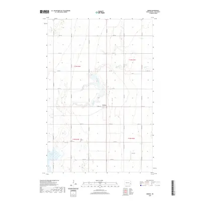
2020 Map of Embden
USGS Topo · Published 2020About this map
The small settlement of Embden serves as the central point of this rural prairie landscape, situated near the winding course of Buffalo Creek. The map reflects the agrarian grid of North Dakota, defined by long stretches of section roads such as 144th Ave SE and 40th St SE. Genealogists will find particular value in the documentation of local burial grounds, including the Tabor Moravian Cem and Saint John's Cem, which anchor the history of the surrounding townships. To the south, Lake Bertha and the Ausk Strip airfield suggest the blend of natural water features and private aviation infrastructure that characterizes this corner of Cass County. The drainage patterns of Buffalo Cr illustrate the subtle topography of the Red River Valley, where the land was meticulously divided for homesteading and development.
Find a feature on this map
30 named features on this map. Tap any name to fly to it.
Don’t see what you’re looking for? This feature index may not catch every label — zoom into the map to look around manually.
Map Details
Editions of this 2020 Embden Map
This is the sole edition of this map. No revisions or reprints were ever made.
Other maps of this area

1895 · Casselton
USGS Topo · 1:125,000

1897 · Tower
USGS Topo · 1:125,000

1897 · Casselton
USGS Topo · 1:125,000

1953 · Fargo
USGS Topo · 1:250,000

1956 · Fargo
USGS Topo · 1:250,000

1961 · Sheldon NW
USGS Topo · 1:24,000
1961 · Sheldon NE
USGS Topo · 1:24,000

1961 · Enderlin North
USGS Topo · 1:24,000

1965 · Alice
USGS Topo · 1:24,000
1967 · Wheatland
USGS Topo · 1:24,000