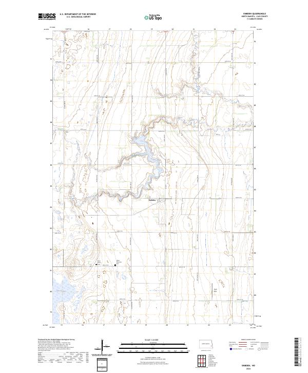
2024 Map of Embden
USGS Topo · Published 2024About this map
Embden serves as a central point in this prairie landscape, where the meandering course of Buffalo Creek winds through the agricultural grid of Cass County. This contemporary survey reveals a mosaic of wetland conservation and rural heritage, characterized by the Cass County Waterfowl Production Area and Lake Bertha to the southwest. The presence of Saint John's Cem and Tabor Moravian Cem near the intersection of 143rd Ave SE and 44th St SE provides significant points of interest for genealogists and local historians documenting the settlement history of the region. The map also records specialized land uses like the Ausk Strip airfield, reflecting the integration of aviation into this traditional farming community. This balance of natural preserves and managed farmland illustrates the modern character of North Dakota's eastern plains.
Find a feature on this map
31 named features on this map. Tap any name to fly to it.
Don’t see what you’re looking for? This feature index may not catch every label — zoom into the map to look around manually.
Map Details
Editions of this 2024 Embden Map
This is the sole edition of this map. No revisions or reprints were ever made.
Other maps of this area

1895 · Casselton
USGS Topo · 1:125,000

1897 · Tower
USGS Topo · 1:125,000

1897 · Casselton
USGS Topo · 1:125,000

1953 · Fargo
USGS Topo · 1:250,000

1956 · Fargo
USGS Topo · 1:250,000

1961 · Sheldon NW
USGS Topo · 1:24,000
1961 · Sheldon NE
USGS Topo · 1:24,000

1961 · Enderlin North
USGS Topo · 1:24,000

1965 · Alice
USGS Topo · 1:24,000
1967 · Wheatland
USGS Topo · 1:24,000