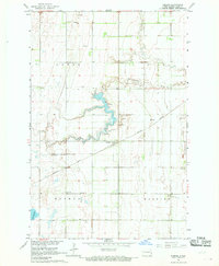
1967 Map of Embden
USGS Topo · Published 1969About this map
The Northern Pacific railroad cuts a diagonal line across this Red River Valley landscape, anchoring the small community of Embden. This 1960s-era survey reveals an agricultural terrain defined by the winding course of Buffalo Creek and numerous extractive sites, including several Sandpit and Gravel Pits located near the rail line. Local heritage and family history are centered around the townships of Howes, Eldred, and Walburg, where rural gathering places such as St Johannes Ch and the neighboring St Johannes Cem served the local population. To the south, Tabor Cem and the waters of Lake Bertha mark the edges of this quiet prairie region, which was mapped as part of a larger effort for the development of the Missouri River Basin.
Find a feature on this map
15 named features on this map. Tap any name to fly to it.
Don’t see what you’re looking for? This feature index may not catch every label — zoom into the map to look around manually.
Map Details
Editions of this 1967 Embden Map
This is the sole edition of this map. No revisions or reprints were ever made.
Other maps of this area

1895 · Casselton
USGS Topo · 1:125,000

1897 · Tower
USGS Topo · 1:125,000

1897 · Casselton
USGS Topo · 1:125,000

1953 · Fargo
USGS Topo · 1:250,000

1956 · Fargo
USGS Topo · 1:250,000

1961 · Sheldon NW
USGS Topo · 1:24,000
1961 · Sheldon NE
USGS Topo · 1:24,000

1961 · Enderlin North
USGS Topo · 1:24,000

1965 · Alice
USGS Topo · 1:24,000
1967 · Wheatland
USGS Topo · 1:24,000