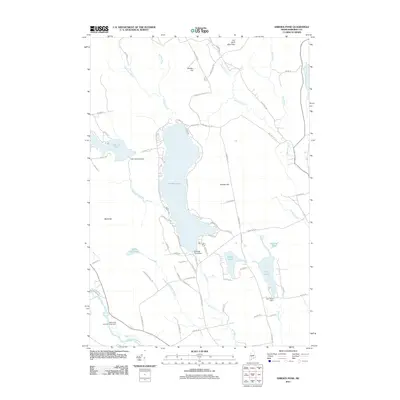
2011 Map of Embden Pond
USGS Topo · Published 2011About this map
Embden Pond serves as the central focal point of this Somerset County landscape, flanked by significant elevations including Dunbar Hill and Savage Hill. The map detail captures the intersection of water and infrastructure, showing the Embden Pond Dam and the Hancock Pond Dam to the west. In the southern reach, the North New Portland Fairgrounds stands near the banks of the Carrabassett River, reflecting the area's agricultural and social gathering traditions. The terrain is defined by a dense network of streams, such as Martin Stream and Witham Brook, which feed into the primary basins. To the east, the Kennebec River corridor marks the boundary, while the smaller Fahi Pond and Boynton Pond cluster together. Local family and place names are preserved through the road network, including Savage Hill Rd and Williams Hill Rd, providing a clear view of how the land was partitioned and accessed in the early 21st century.
Find a feature on this map
72 named features on this map. Tap any name to fly to it.
Don’t see what you’re looking for? This feature index may not catch every label — zoom into the map to look around manually.
Map Details
Editions of this 2011 Embden Pond Map
This is the sole edition of this map. No revisions or reprints were ever made.
Other maps of this area

1903 · Bingham
USGS Topo · 1:62,500

1904 · Anson
USGS Topo · 1:62,500

1905 · Bingham
USGS Topo · 1:62,500

1928 · Dead River
USGS Topo · 1:62,500

1930 · Kingfield
USGS Topo · 1:48,000

1931 · Dead River
USGS Topo · 1:48,000

1932 · Kingfield
USGS Topo · 1:62,500

1944 · Dead River
USGS Topo · 1:62,500

1948 · Bangor
USGS Topo · 1:250,000

1949 · Jackman
USGS Topo · 1:250,000