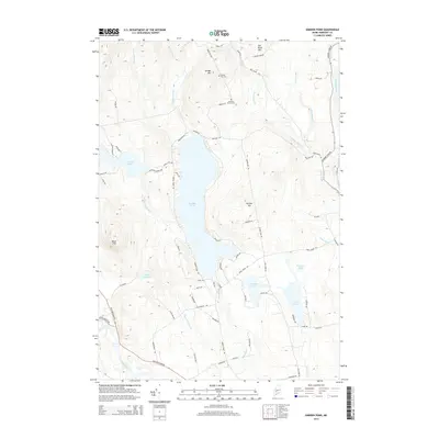
2014 Map of Embden Pond
USGS Topo · Published 2014About this map
Embden Pond and the surrounding Somerset County highlands are defined by a network of glacial lakes and significant river corridors. In this 2014 representation, the land between the Kennebec River and the Carrabassett River is marked by prominent elevations like Old Bluff Mtn, Savage Hill, and Dunbar Hill. Local history is anchored by the Savage Hill Cem and Concord Corner Cem, reflecting early settlement patterns in this part of Maine.
Find a feature on this map
72 named features on this map. Tap any name to fly to it.
Don’t see what you’re looking for? This feature index may not catch every label — zoom into the map to look around manually.
Map Details
Editions of this 2014 Embden Pond Map
This is the sole edition of this map. No revisions or reprints were ever made.
Other maps of this area

1903 · Bingham
USGS Topo · 1:62,500

1904 · Anson
USGS Topo · 1:62,500

1905 · Bingham
USGS Topo · 1:62,500

1928 · Dead River
USGS Topo · 1:62,500

1930 · Kingfield
USGS Topo · 1:48,000

1931 · Dead River
USGS Topo · 1:48,000

1932 · Kingfield
USGS Topo · 1:62,500

1944 · Dead River
USGS Topo · 1:62,500

1948 · Bangor
USGS Topo · 1:250,000

1949 · Jackman
USGS Topo · 1:250,000