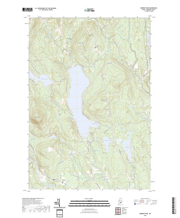
2024 Map of Embden Pond
USGS Topo · Published 2024About this map
Embden Pond and the surrounding highlands of Somerset County dominate this landscape, where the waters of the Kennebec River and Carrabassett River bracket a region of significant local heritage. The settlement at Concord Corner and family-named landmarks like Savage Hill reflect generations of land use in this part of Maine. Genealogists will find several notable burial sites including the Pierce Purington Cem, Hill Cem, and Cragin Cem, which are situated near old thoroughfares such as Embden Pond Rd and Creamer Rd. The map details a complex system of ponds and streams, from the large Hancock Pond in the west to smaller bodies like Sandy Pond, Fahi Pond, and Boynton Pond in the east, illustrating the interconnected drainage patterns of the Kennebec watershed.
Find a feature on this map
77 named features on this map. Tap any name to fly to it.
Don’t see what you’re looking for? This feature index may not catch every label — zoom into the map to look around manually.
Map Details
Editions of this 2024 Embden Pond Map
This is the sole edition of this map. No revisions or reprints were ever made.
Other maps of this area

1903 · Bingham
USGS Topo · 1:62,500

1904 · Anson
USGS Topo · 1:62,500

1905 · Bingham
USGS Topo · 1:62,500

1928 · Dead River
USGS Topo · 1:62,500

1930 · Kingfield
USGS Topo · 1:48,000

1931 · Dead River
USGS Topo · 1:48,000

1932 · Kingfield
USGS Topo · 1:62,500

1944 · Dead River
USGS Topo · 1:62,500

1948 · Bangor
USGS Topo · 1:250,000

1949 · Jackman
USGS Topo · 1:250,000