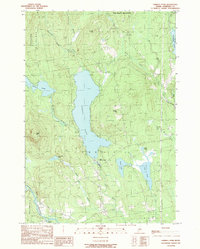
1989 Map of Embden Pond
USGS Topo · Published 1989About this map
Embden Pond dominates the center of this Somerset County landscape, serving as a focal point for the surrounding townships of Embden, Concord, and Lexington. The map illustrates a complex network of water bodies and drainages, from the Carrabassett River in the southwest to the Kennebec River in the northeast. This 1980s survey captures a transition in land use, where traditional landmarks like the State Fish Hatchery and local Cem sites sit alongside modern utility infrastructure like the prominent north-south Transmission Line.
Find a feature on this map
35 named features on this map. Tap any name to fly to it.
Don’t see what you’re looking for? This feature index may not catch every label — zoom into the map to look around manually.
Map Details
Editions of this 1989 Embden Pond Map
This is the sole edition of this map. No revisions or reprints were ever made.
Other maps of this area

1903 · Bingham
USGS Topo · 1:62,500

1904 · Anson
USGS Topo · 1:62,500

1905 · Bingham
USGS Topo · 1:62,500

1928 · Dead River
USGS Topo · 1:62,500

1930 · Kingfield
USGS Topo · 1:48,000

1931 · Dead River
USGS Topo · 1:48,000

1932 · Kingfield
USGS Topo · 1:62,500

1944 · Dead River
USGS Topo · 1:62,500

1948 · Bangor
USGS Topo · 1:250,000

1949 · Jackman
USGS Topo · 1:250,000