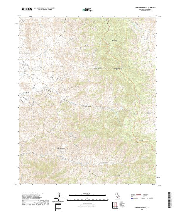
2021 Map of Emerald Mountain
USGS Topo · Published 2021About this map
Sierra Nevada topography dominates this 2021 study, where the Piute Mountains and high ridgelines create a complex network of canyons and passes. The Pacific Crest National Scenic Trl traverses the eastern half of the sheet, crossing through Hamp Williams Pass and skirting the slopes of Weldon Peak. These high-elevation trails and roads, such as John Fremont Rd, trace routes through a landscape defined by seasonal water sources like Soda Springs and Miller Springs.
Find a feature on this map
57 named features on this map. Tap any name to fly to it.
Don’t see what you’re looking for? This feature index may not catch every label — zoom into the map to look around manually.
Map Details
Editions of this 2021 Emerald Mountain Map
This is the sole edition of this map. No revisions or reprints were ever made.
Other maps of this area

1915 · Mojave
USGS Topo · 1:125,000

1943 · Tehachapi
USGS Topo · 1:62,500

1943 · Cross Mountain
USGS Topo · 1:62,500

1943 · Emerald Mtn
USGS Topo · 1:62,500

1943 · Mojave
USGS Topo · 1:62,500

1948 · Bakersfield
USGS Topo · 1:250,000

1955 · Bakersfield
USGS Topo · 1:250,000

1956 · Bakersfield
USGS Topo · 1:250,000
1956 · Mojave
USGS Topo · 1:62,500

1960 · Bakersfield
USGS Topo · 1:250,000