1943 Map of Emerald Mtn
USGS Topo · Published 1959About this map
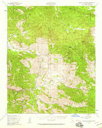
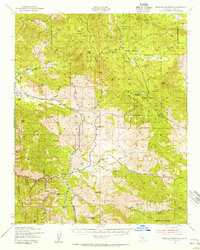
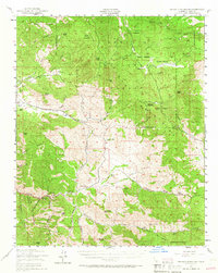
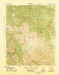
Claraville and the rugged interior of the Sequoia National Forest anchor this mid-century survey of eastern Kern County. The landscape is defined by the high peaks of Red Mountain, Piute Peak, and Emerald Mountain, interspersed with scattered ranching outposts like Cannon Ranch and Schneider Plate Ranch. This era of documentation reveals a transition between old-world resource extraction and modern forest management, evidenced by the presence of the Piute Lookout and The George Lodge.
Find a feature on this map
64 named features on this map. Tap any name to fly to it.
Don’t see what you’re looking for? This feature index may not catch every label — zoom into the map to look around manually.
Map Details
Editions of this 1943 Emerald Mtn Map
4 editions found
Other maps of this area

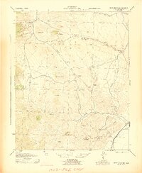
1906 · Kernville
USGS Topo · 1:125,000

1908 · Kernville
USGS Topo · 1:125,000

1914 · Caliente
USGS Topo · 1:125,000

1915 · Mojave
USGS Topo · 1:125,000

1920 · Delonagha
USGS Topo · 1:62,500

1926 · Glennville
USGS Topo · 1:62,500

1936 · Tobias Peak
USGS Topo · 1:125,000

1943 · Tehachapi
USGS Topo · 1:62,500
1943 · Cross Mountain
USGS Topo · 1:62,500
1943 · Emerald Mtn
USGS Topo · 1:62,500