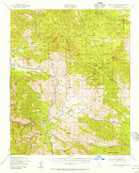
1943 Map of Emerald Mtn
USGS Topo · Published 1956About this map
Sequoia National Forest dominates much of this high-elevation terrain, where remote mining camps and family ranches define the early 1940s landscape. The settlement of Claraville sits tucked away in the upper elevations, while the southern reaches of the quadrangle feature the more developed valley areas around Loraine and Twin Oaks. A robust mining economy is evident throughout the mountain slopes, documented by the presence of the Walker Mine, Gwynne Mine, and Lori Mine.
Find a feature on this map
78 named features on this map. Tap any name to fly to it.
Don’t see what you’re looking for? This feature index may not catch every label — zoom into the map to look around manually.
Map Details
Editions of this 1943 Emerald Mtn Map
4 editions found
Other maps of this area

1906 · Kernville
USGS Topo · 1:125,000

1908 · Kernville
USGS Topo · 1:125,000

1914 · Caliente
USGS Topo · 1:125,000

1915 · Mojave
USGS Topo · 1:125,000

1920 · Delonagha
USGS Topo · 1:62,500

1926 · Glennville
USGS Topo · 1:62,500

1936 · Tobias Peak
USGS Topo · 1:125,000

1943 · Tehachapi
USGS Topo · 1:62,500

1943 · Cross Mountain
USGS Topo · 1:62,500

1943 · Emerald Mtn
USGS Topo · 1:62,500