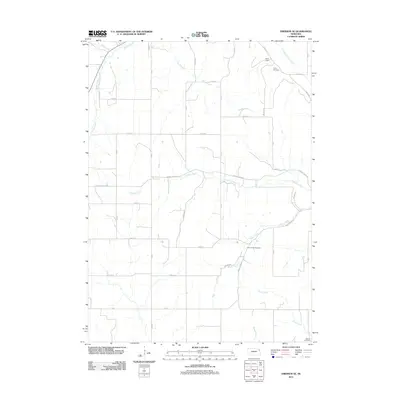
2011 Map of Emerson SE
USGS Topo · Published 2011About this map
Green Valley Cemetery and Taylor Cemetery serve as important landmarks within this agricultural landscape of Dakota County, where the terrain is defined by a dense network of meandering waterways. The drainage pattern is complex, featuring the winding courses of Pigeon Creek, Fiddlers Creek, and Wigle Creek, which segment the geometric grid of rural roads. A notable piece of local water management infrastructure is the Hirch Dam in the northern reaches, situated near the Pigeon Creek Ditch, indicating the historical efforts to manage the flow through these bottomlands.
Find a feature on this map
41 named features on this map. Tap any name to fly to it.
Don’t see what you’re looking for? This feature index may not catch every label — zoom into the map to look around manually.
Map Details
Editions of this 2011 Emerson SE Map
This is the sole edition of this map. No revisions or reprints were ever made.
Other maps of this area

1955 · Sioux City
USGS Topo · 1:250,000

1958 · Sioux City
USGS Topo · 1:250,000

1959 · Sioux City
USGS Topo · 1:250,000

1963 · Sioux City South
USGS Topo · 1:24,000

1964 · Homer
USGS Topo · 1:24,000

1966 · Walthill
USGS Topo · 1:24,000

1966 · Thurston
USGS Topo · 1:24,000

1966 · Pender NE
USGS Topo · 1:24,000

1967 · Waterbury
USGS Topo · 1:24,000
1967 · Jackson
USGS Topo · 1:24,000