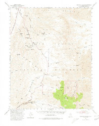
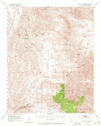
1952 Map of Emigrant Canyon
USGS Topo · Published 1980About this map
The Panamint Range dominates this landscape within Death Valley National Monument, revealing a high-desert environment defined by mining camps and remote springs. Mineral exploration centers on the town of Skidoo and the settlement at Harrisburg, both of which are surrounded by numerous Mines and Prospects. The industrial imprint of the era is further marked by the Napoleon Mine and Argenta Mine, while the infrastructure of the early motorized era is preserved in the route of the Old Eichbaum Toll Road winding through Emigrant Canyon.
Find a feature on this map
57 named features on this map. Tap any name to fly to it.
Don’t see what you’re looking for? This feature index may not catch every label — zoom into the map to look around manually.
Map Details
Editions of this 1952 Emigrant Canyon Map
6 editions found

Other maps of this area

1908 · Furnace Creek
USGS Topo · 1:250,000

1908 · Ballarat
USGS Topo · 1:250,000

1910 · Furnace Creek
USGS Topo · 1:250,000

1913 · Ballarat
USGS Topo · 1:250,000

1942 · Bullfrog
USGS Topo · 1:125,000

1948 · Death Valley
USGS Topo · 1:250,000

1951 · Panamint Butte
USGS Topo · 1:62,500

1951 · Maturango Peak
USGS Topo · 1:62,500

1951 · Marble Canyon
USGS Topo · 1:62,500

1952 · Chloride Cliff
USGS Topo · 1:50,000