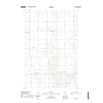
2020 Map of Emmet NE
USGS Topo · Published 2020About this map
The rolling agricultural landscape of McLean County is defined by the drainage basins of the Douglas Creek system. Both the Middle Br Douglas Cr and the E Br Douglas Cr (also identified as the East Branch Douglas Creek) meander through the prairie, creating a network of coulees and wetlands that shape the section-line road grid. This modern survey reflects the enduring rural character of North Dakota, where large-scale land management is punctuated by small, localized landmarks. Notable sites include the Clifton Cem in the northwest and the Fischer Private Airport, illustrating the blend of early pioneer history and contemporary regional aviation. The map provides a precise look at the township and range boundaries that have governed this territory since settlement, showing how the natural topography of the creek branches interacts with the surveyed lines of the North American Datum of 1983.
Find a feature on this map
21 named features on this map. Tap any name to fly to it.
Don’t see what you’re looking for? This feature index may not catch every label — zoom into the map to look around manually.
Map Details
Editions of this 2020 Emmet NE Map
This is the sole edition of this map. No revisions or reprints were ever made.
Other maps of this area

1922 · Garrison
USGS Topo · 1:62,500

1954 · McClusky
USGS Topo · 1:250,000

1956 · Emmet NE
USGS Topo · 1:24,000

1956 · Blue Hill
USGS Topo · 1:24,000

1956 · Emmet
USGS Topo · 1:24,000

1956 · Douglas West
USGS Topo · 1:24,000

1958 · McClusky
USGS Topo · 1:250,000

1967 · Emmet SE
USGS Topo · 1:24,000

1967 · Emmet SW
USGS Topo · 1:24,000
1972 · Garrison Dam North
USGS Topo · 1:24,000