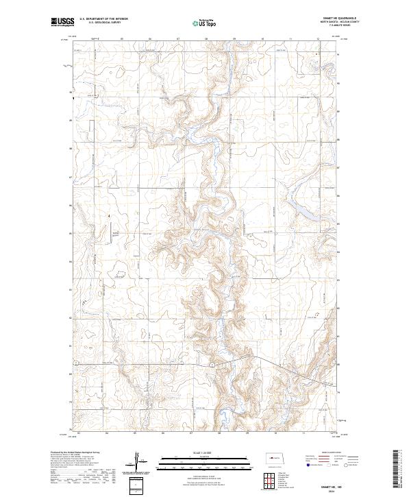
2024 Map of Emmet NE
USGS Topo · Published 2024About this map
The rolling plains of McLean County are defined by the winding drainages of Middle Branch Douglas Creek and East Branch Douglas Creek. This topographic record illustrates a quintessential North Dakota agricultural landscape, organized by a strict rectangular grid of section lines and gravel roads such as 19th St NW and 22nd St NW. Centrally located in this rural expanse is Fischer Airport, a local landmark serving the surrounding farming communities. The survey reveals the intricate topography of the creek valleys, contrasting with the flat upland sections typical of the Missouri Plateau. A network of county routes, including Co Hwy 6 and Co Hwy 16, provides the primary transit corridors through this sparsely populated territory.
Find a feature on this map
19 named features on this map. Tap any name to fly to it.
Don’t see what you’re looking for? This feature index may not catch every label — zoom into the map to look around manually.
Map Details
Editions of this 2024 Emmet NE Map
This is the sole edition of this map. No revisions or reprints were ever made.
Other maps of this area

1922 · Garrison
USGS Topo · 1:62,500

1954 · McClusky
USGS Topo · 1:250,000

1956 · Emmet NE
USGS Topo · 1:24,000

1956 · Blue Hill
USGS Topo · 1:24,000

1956 · Emmet
USGS Topo · 1:24,000

1956 · Douglas West
USGS Topo · 1:24,000

1958 · McClusky
USGS Topo · 1:250,000

1967 · Emmet SE
USGS Topo · 1:24,000

1967 · Emmet SW
USGS Topo · 1:24,000
1972 · Garrison Dam North
USGS Topo · 1:24,000