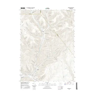
2016 Map of Emporium
USGS Topo · Published 2016About this map
Emporium sits at the southern edge of this landscape where West Creek meets the waters flowing down from the north. The valley of Sinnemahoning Portage Creek serves as a primary corridor, carrying the Portage Rd past the settlement of Sizerville and the waters of Lake Bucktail. The surrounding terrain is defined by a dense network of hollows, many bearing the names of early settlers and industrial uses, such as Slaughter House Hollow, Buffalo Switch Hollow, and Stone Chimney Hollow. Near the town center, local history is preserved at Newton Cem and Saint Marks Cem, while the northern reaches transition into the high ridges of McKean Co and Potter Co. The presence of several reservoirs, including Upper Reservoir and Salt Run Reservoir, highlights the managed water resources vital to the community's development.
Find a feature on this map
91 named features on this map. Tap any name to fly to it.
Don’t see what you’re looking for? This feature index may not catch every label — zoom into the map to look around manually.
Map Details
Editions of this 2016 Emporium Map
This is the sole edition of this map. No revisions or reprints were ever made.
Other maps of this area

1941 · Benezette
USGS Topo · 1:62,500

1943 · Benezette
USGS Topo · 1:62,500

1945 · Driftwood
USGS Topo · 1:48,000

1945 · First Fork
USGS Topo · 1:24,000

1945 · Cameron
USGS Topo · 1:24,000

1947 · Cameron
USGS Topo · 1:24,000

1947 · First Fork
USGS Topo · 1:24,000

1948 · Crosby
USGS Topo · 1:62,500

1948 · Emporium
USGS Topo · 1:62,500

1948 · Keating Summit
USGS Topo · 1:24,000
Featured Places
- Emporium, PA
- Norwich Township, PA
- Gardeau, Norwich Township
- Prospect Park, Shippen Township
- Lumber Township, PA