
1948 Map of Emporium
USGS Topo · Published 1952About this map
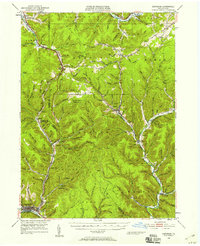
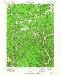
The Allegheny River and Sinnemahoning Creek headwaters define this rugged landscape at the border of McKean, Potter, and Cameron counties. This mid-century survey reveals a region deeply tied to its mountain topography, where small settlements like Keating Summit, Austin, and Costello are strung along narrow valley corridors. The Pennsylvania railroad winds through the north, crossing the divide at Keating Summit, a critical point in the local rail network of the era.
Find a feature on this map
78 named features on this map. Tap any name to fly to it.
Don’t see what you’re looking for? This feature index may not catch every label — zoom into the map to look around manually.
Map Details
Editions of this 1948 Emporium Map
Other maps of this area

1932 · Genesee
USGS Topo · 1:62,500

1933 · Smethport
USGS Topo · 1:62,500

1934 · Coudersport
USGS Topo · 1:48,000

1937 · Genesee
USGS Topo · 1:62,500

1937 · Smethport
USGS Topo · 1:62,500

1938 · Coudersport
USGS Topo · 1:62,500

1941 · Benezette
USGS Topo · 1:62,500

1943 · Benezette
USGS Topo · 1:62,500

1945 · Driftwood
USGS Topo · 1:48,000

1945 · First Fork
USGS Topo · 1:24,000