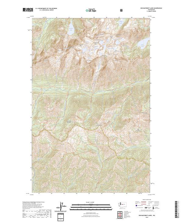
2023 Map of Enchantment Lakes
USGS Topo · Published 2023About this map
The Stuart Range and Wenatchee Mountains dominate this high-elevation landscape within the Alpine Lakes Wilderness. Central to the map is the Enchantment Basin, a granite-carved plateau containing a chain of alpine water bodies including Inspiration Lake, Perfection Lake, and Lake Viviane. The glacial history of the region is evident in the presence of the Snow Creek Glacier and Colchuck Glacier, which sit below prominent summits like Dragontail Peak and Little Annapurna. This modern topographic study shows the complex trail network used to navigate the sharp relief, such as the Ingalls Creek Trl and Stuart Lake Trl. To the northeast, the Leavenworth National Fish Hatchery represents a managed point of interest where the high-mountain hydrology meets the lower valleys of the Wenatchee National Forest.
Find a feature on this map
54 named features on this map. Tap any name to fly to it.
Don’t see what you’re looking for? This feature index may not catch every label — zoom into the map to look around manually.
Map Details
Editions of this 2023 Enchantment Lakes Map
This is the sole edition of this map. No revisions or reprints were ever made.
Other maps of this area

1897 · Mount Stuart
USGS Topo · 1:125,000

1901 · Chiwaukum
USGS Topo · 1:125,000

1902 · Mount Stuart
USGS Topo · 1:125,000

1904 · Chiwaukum
USGS Topo · 1:125,000

1957 · Wenatchee
USGS Topo · 1:250,000

1961 · Liberty
USGS Topo · 1:62,500

1961 · Mount Stuart
USGS Topo · 1:62,500

1964 · Leavenworth
USGS Topo · 1:62,500

1965 · Chiwaukum Mts
USGS Topo · 1:62,500

1975 · Wenatchee
USGS Topo · 1:100,000