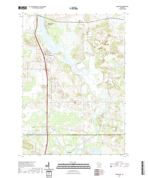
2022 Map of Endeavor
USGS Topo · Published 2022About this map
The Fox River snakes through the heart of this central Wisconsin landscape, defining the boundaries and character of the village of Endeavor. This 2022 survey illustrates a region where water and topography dictate human settlement, from the residential clusters at Buffalo Shore Estates to the smaller hamlet of Anacker near the southern border of Marquette Co and Columbia Co. The river widens near Packwaukee Island, surrounded by extensive wetlands that characterize the drainage basins of Chapman Creek and Neenah Creek. Genealogists will find three significant burial sites documented: Hill Crest Cem near the village center, Moundville Cem to the south, and the more secluded Rood Cem near the river's lower reaches. The map captures a contemporary look at this historic river corridor, including the Oak Savanna Trl and the secluded Ennis Lake.
Find a feature on this map
64 named features on this map. Tap any name to fly to it.
Don’t see what you’re looking for? This feature index may not catch every label — zoom into the map to look around manually.
Map Details
Editions of this 2022 Endeavor Map
This is the sole edition of this map. No revisions or reprints were ever made.
Other maps of this area

1902 · Portage
USGS Topo · 1:62,500

1902 · Briggsville
USGS Topo · 1:62,500

1957 · Madison
USGS Topo · 1:250,000

1958 · Briggsville
USGS Topo · 1:62,500

1960 · Madison
USGS Topo · 1:250,000

1961 · Oxford
USGS Topo · 1:62,500

1961 · Montello
USGS Topo · 1:62,500

1962 · Portage
USGS Topo · 1:62,500
1975 · Pine Island
USGS Topo · 1:24,000
1975 · Briggsville
USGS Topo · 1:24,000