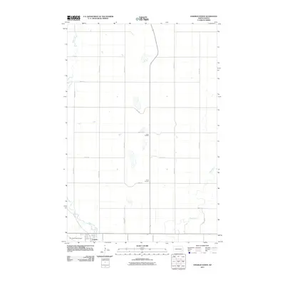
2011 Map of Enderlin North
USGS Topo · Published 2011About this map
Enderlin sits at the southern edge of this landscape, where the northern residential and industrial streets meet the meandering path of the Maple River. The town layout is defined by historical thoroughfares like Railway St and Dehuke Ave, reflecting a community built around the transit and trade of the eastern North Dakota plains. Beyond the town limits, the terrain transitions into a strictly organized grid of agricultural section lines, including 138th Ave SE and 51st St SE. This rural expanse is punctuated by small, significant landmarks of local heritage, such as Salem Cemetery and Trinity Cemetery, which serve as quiet anchors for the surrounding farming families. In the southwest, the Sky Haven Ranch Airport provides a modern aeronautical connection to this otherwise traditional prairie environment, illustrating the continued utility of the land in the early 21st century.
Find a feature on this map
21 named features on this map. Tap any name to fly to it.
Don’t see what you’re looking for? This feature index may not catch every label — zoom into the map to look around manually.
Map Details
Editions of this 2011 Enderlin North Map
This is the sole edition of this map. No revisions or reprints were ever made.
Other maps of this area

1895 · Casselton
USGS Topo · 1:125,000

1897 · Tower
USGS Topo · 1:125,000

1897 · Casselton
USGS Topo · 1:125,000

1953 · Fargo
USGS Topo · 1:250,000

1956 · Fargo
USGS Topo · 1:250,000

1960 · Enderlin South
USGS Topo · 1:24,000
1960 · Sheldon
USGS Topo · 1:24,000

1961 · Sheldon NW
USGS Topo · 1:24,000

1961 · Enderlin North
USGS Topo · 1:24,000

1965 · Alice
USGS Topo · 1:24,000