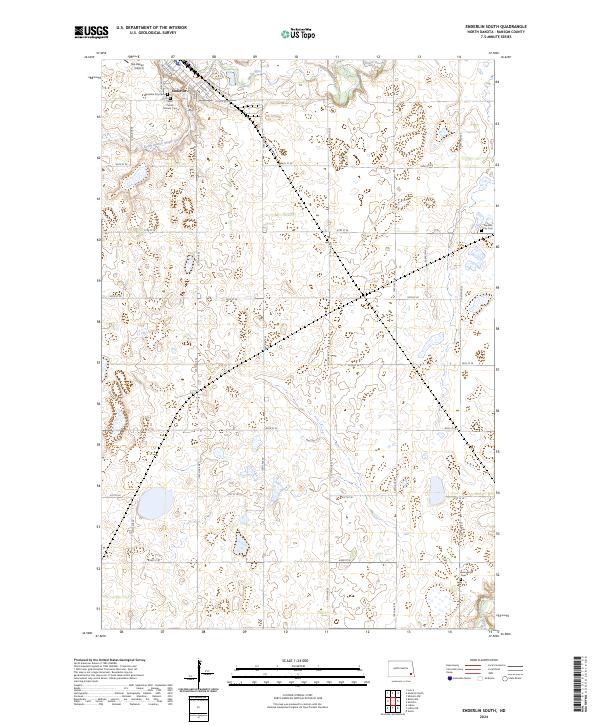
2024 Map of Enderlin South
USGS Topo · Published 2024About this map
Enderlin sits at the northern edge of this landscape, where the Maple River and South Branch Maple River converge. The town's grid is clearly defined by historical thoroughfares like Center St and Railway St, reflecting its development alongside the Soo St rail corridor. Beyond the residential center, the geography is dotted with significant local landmarks, including Sky Haven Airport and several burial grounds such as the Enderlin City Cem and Saint Patrick Catholic Cem. To the south, the landscape transitions into a conserved prairie wetland environment, dominated by the Ransom County Waterfowl Production Area and the winding course of the Sheyenne River in the southeastern corner. This modern survey illustrates the persistent rural character of Ransom County, where section roads like 58th St SE and 137th Ave SE divide a territory of agricultural fields and water-filled depressions.
Find a feature on this map
37 named features on this map. Tap any name to fly to it.
Don’t see what you’re looking for? This feature index may not catch every label — zoom into the map to look around manually.
Map Details
Editions of this 2024 Enderlin South Map
This is the sole edition of this map. No revisions or reprints were ever made.
Other maps of this area

1895 · Casselton
USGS Topo · 1:125,000

1897 · Tower
USGS Topo · 1:125,000

1897 · Casselton
USGS Topo · 1:125,000

1907 · Wyndmere
USGS Topo · 1:125,000

1953 · Fargo
USGS Topo · 1:250,000

1956 · Fargo
USGS Topo · 1:250,000

1960 · Lisbon NE
USGS Topo · 1:24,000

1960 · Enderlin South
USGS Topo · 1:24,000

1960 · Venlo
USGS Topo · 1:24,000
1960 · Sheldon
USGS Topo · 1:24,000