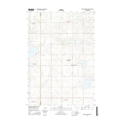
2015 Map of Enemy Swim Lake East
USGS Topo · Published 2015About this map
Coteau des Prairies defines the elevated topography of this Roberts County landscape, where glacial activity left behind a series of significant water bodies. The eastern portion of Enemy Swim Lake is a primary focal point, bordered by residential routes like Lake Dr N and E Lake Dr. To the east, the terrain is dotted with Hurricane Lake and Owl Lake, while Oak Island stands as a distinct topographic rise in the northern sections. The rural settlement pattern is anchored by Rudebusch Corner, situated at a crossroads on the plateau. A rigid grid of section roads, including 451st Ave and 135th St, provides access to the surrounding agricultural lands and marks the boundary line where Day Co and Roberts Co meet. The map illustrates a region where glacial landforms and water systems continue to dictate the placement of roads and small communities.
Find a feature on this map
31 named features on this map. Tap any name to fly to it.
Don’t see what you’re looking for? This feature index may not catch every label — zoom into the map to look around manually.
Map Details
Editions of this 2015 Enemy Swim Lake East Map
This is the sole edition of this map. No revisions or reprints were ever made.
Other maps of this area

1953 · Milbank
USGS Topo · 1:250,000

1958 · Milbank
USGS Topo · 1:250,000

1970 · Summit
USGS Topo · 1:24,000

1970 · Summit NE
USGS Topo · 1:24,000

1970 · Waubay
USGS Topo · 1:24,000

1970 · Piyas Lake
USGS Topo · 1:24,000

1970 · Enemy Swim Lake East
USGS Topo · 1:24,000

1970 · Ortley
USGS Topo · 1:24,000

1970 · Goodwill
USGS Topo · 1:24,000

1970 · Drywood Lakes
USGS Topo · 1:24,000
Featured Places
- Old Agency District, SD
- Rudebusch Corner, Enemy Swim District
- Enemy Swim District, SD
- Roberts County, SD
- Day County, SD