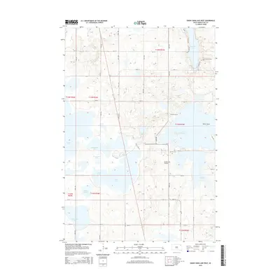
2015 Map of Enemy Swim Lake West
USGS Topo · Published 2015About this map
The glacial waters of the Coteau des Prairies plateau dominate this South Dakota landscape, characterized by a complex network of lakes and marshes in the Enemy Swim District. Enemy Swim Lake sits at the center of the region, featuring Parker Island and connecting to surrounding water bodies like Pickerel Lake and Waubay Lake. The arrangement of these basins suggests the erratic drainage patterns of the prairie coteau, where many waters like Swan Pond and Dahling Slough are landlocked or seasonally fluctuating.
Find a feature on this map
40 named features on this map. Tap any name to fly to it.
Don’t see what you’re looking for? This feature index may not catch every label — zoom into the map to look around manually.
Map Details
Editions of this 2015 Enemy Swim Lake West Map
This is the sole edition of this map. No revisions or reprints were ever made.
Other maps of this area

1953 · Milbank
USGS Topo · 1:250,000

1958 · Milbank
USGS Topo · 1:250,000

1970 · Eden
USGS Topo · 1:24,000

1970 · Waubay
USGS Topo · 1:24,000

1970 · Piyas Lake
USGS Topo · 1:24,000

1970 · Enemy Swim Lake East
USGS Topo · 1:24,000

1970 · Waubay SW
USGS Topo · 1:24,000

1970 · Roslyn
USGS Topo · 1:24,000

1970 · Ortley
USGS Topo · 1:24,000

1970 · Drywood Lakes
USGS Topo · 1:24,000