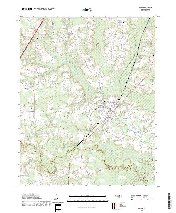
2022 Map of Enfield
USGS Topo · Published 2022About this map
Enfield serves as the focal point of this coastal plain landscape, where the confluence of three North Carolina counties — Halifax, Nash, and Edgecombe — meets near the winding course of Fishing Creek. The town's grid, including Sherrod Hts, is defined by its relationship to the rail corridor and the surrounding wetlands that dominate the geography.
Find a feature on this map
76 named features on this map. Tap any name to fly to it.
Don’t see what you’re looking for? This feature index may not catch every label — zoom into the map to look around manually.
Map Details
Editions of this 2022 Enfield Map
This is the sole edition of this map. No revisions or reprints were ever made.
Other maps of this area

1953 · Norfolk
USGS Topo · 1:250,000

1960 · Dawson Crossroads
USGS Topo · 1:24,000

1960 · Draughn
USGS Topo · 1:24,000

1961 · Whitakers
USGS Topo · 1:24,000

1961 · Enfield
USGS Topo · 1:24,000

1963 · Ringwood
USGS Topo · 1:24,000

1963 · Drake
USGS Topo · 1:24,000

1973 · Aurelian Springs
USGS Topo · 1:24,000

1974 · Halifax
USGS Topo · 1:24,000

1974 · Darlington
USGS Topo · 1:24,000