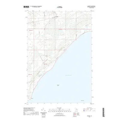
2019 Map of Engadine
USGS Topo · Published 2019About this map
The settlement of Engadine serves as the northern anchor of this landscape on Michigan's Upper Peninsula, where the local road network including Stimich Rd and Melville St gives way to a complex wetland environment. South of the village, the terrain transitions into a vast expanse of marshes and small water bodies like Miller Lake, Mud Lake, and Amadon Pond. This hydrologic network is defined by the winding courses of the Rock River and the Crow River as they drain toward the northern shore of Lake Michigan.
Find a feature on this map
34 named features on this map. Tap any name to fly to it.
Don’t see what you’re looking for? This feature index may not catch every label — zoom into the map to look around manually.
Map Details
Editions of this 2019 Engadine Map
This is the sole edition of this map. No revisions or reprints were ever made.
Other maps of this area

1931 · Gould City NE
USGS Topo · 1:31,680

1931 · Gould City NW
USGS Topo · 1:31,680

1931 · Gould City SE
USGS Topo · 1:31,680

1931 · Gilchrist NW
USGS Topo · 1:31,680

1954 · Sault Sainte Marie
USGS Topo · 1:250,000

1955 · Hog Island
USGS Topo · 1:62,500

1955 · Cheboygan
USGS Topo · 1:250,000

1956 · Sault Sainte Marie
USGS Topo · 1:250,000

1957 · Sault Sainte Marie
USGS Topo · 1:250,000

1958 · Cheboygan
USGS Topo · 1:250,000