
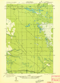
1931 Map of Gilchrist NW
USGS Topo · Published 1931About this map
Gilchrist stands as a focal point in this 1930s survey of the Upper Peninsula, situated at the junction of critical transit corridors. The Minneapolis St Paul and Sault Ste Marie railroad and its companion Minneapolis St Paul and Sault Ste Marie Highway cut across the southern landscape, following a path through Garfield and Pentland townships. This era of mapping, compiled in part from Air Corps aerial photographs, reveals a complex network of wetlands and small water bodies. The drainage patterns are defined by the North Branch Cold Creek and South Branch Cold Creek, which meander through the timbered reaches toward the Black River. Numerous small lakes, including Dunmore Lake, Pullup Lake, and the aptly named Cranberry Lake, dot the glacial terrain, illustrating the water-rich geography of the Luce and Mackinac county border.
Find a feature on this map
16 named features on this map. Tap any name to fly to it.
Don’t see what you’re looking for? This feature index may not catch every label — zoom into the map to look around manually.
Map Details
Editions of this 1931 Gilchrist NW Map
2 editions found
Other maps of this area

1931 · Gould City NE
USGS Topo · 1:31,680

1931 · Gould City SE
USGS Topo · 1:31,680

1931 · Gilchrist NE
USGS Topo · 1:31,680

1954 · Sault Sainte Marie
USGS Topo · 1:250,000

1956 · Sault Sainte Marie
USGS Topo · 1:250,000

1957 · Sault Sainte Marie
USGS Topo · 1:250,000

1958 · Sault Sainte Marie
USGS Topo · 1:250,000
1973 · Newberry
USGS Topo · 1:24,000
1973 · Hog Island Point
USGS Topo · 1:24,000
1973 · Gilchrist
USGS Topo · 1:24,000