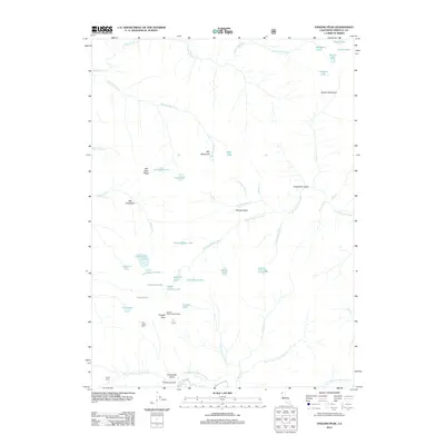
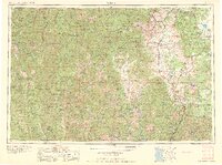
2012 Map of English Peak
USGS Topo · Published 2012About this map
English Peak Lookout Tower stands as the primary vantage point over this high-altitude landscape in the Marble Mountain Wilderness area of the Klamath National Forest. The terrain is defined by a dense network of alpine lakes and glacial basins, including Lake of the Island, Hancock Lake, and Lake Ethel, which feed the headwaters of the N Fork Salmon River and Wooley Cr. This 2012 survey illustrates the remote character of the region, where human presence is marked only by isolated structures like the Tom Taylor Cabin and Smith Cabin. The distribution of Big Meadows and Grants Meadows among steep features such as Hell Hole Ridge and English Peak shows the classic drainage patterns that have shaped this portion of Siskiyou County for generations of foresters and backcountry travelers.
Find a feature on this map
53 named features on this map. Tap any name to fly to it.
Don’t see what you’re looking for? This feature index may not catch every label — zoom into the map to look around manually.
Map Details
Editions of this 2012 English Peak Map
This is the sole edition of this map. No revisions or reprints were ever made.
Other maps of this area
1914 · Seiad
USGS Topo · 1:125,000
1922 · Seiad
USGS Topo · 1:125,000

1948 · Weed
USGS Topo · 1:250,000

1950 · Weed
USGS Topo · 1:250,000
1955 · Sawyers Bar
USGS Topo · 1:62,500
1955 · Ukonom Lake
USGS Topo · 1:62,500
1955 · Scott Bar
USGS Topo · 1:62,500
1955 · Forks of Salmon
USGS Topo · 1:62,500
1958 · Weed
USGS Topo · 1:250,000
1963 · Weed
USGS Topo · 1:250,000