
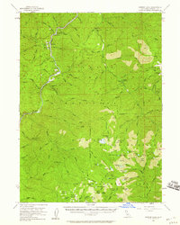
1955 Map of Ukonom Lake
USGS Topo · Published 1957About this map
The Klamath River carves a deep path through the northern reaches of the Klamath National Forest in this mid-century topographic record. Mining activity is central to the local geography, with the Bunker Hill Mine, Siskiyou Mine, and Independence Mine appearing as significant landmarks along the river's rugged tributaries. The map documents the early infrastructure of the Marble Mountain Wilderness Area, detailing backcountry sites like Cedar Flat Cabin, the Ukonom Lookout, and various meadows including Hells Meadows and Haypress Meadows. The presence of the State Honor Camp and Pick-i-a-wish Campground near the mouth of Clear Creek reflects the era's emerging focus on both institutional land management and public recreation. Small river-based sites such as Ferry Pt and Wingate Bar underscore the historical reliance on the Klamath corridor for transit and small-scale settlement in this corner of Siskiyou County.
Find a feature on this map
102 named features on this map. Tap any name to fly to it.
Don’t see what you’re looking for? This feature index may not catch every label — zoom into the map to look around manually.
Map Details
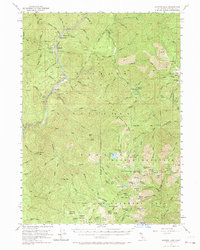
Editions of this 1955 Ukonom Lake Map
3 editions found
Other maps of this area

1914 · Seiad
USGS Topo · 1:125,000

1922 · Preston Peak
USGS Topo · 1:125,000

1922 · Seiad
USGS Topo · 1:125,000

1925 · Hoopa
USGS Topo · 1:125,000

1948 · Weed
USGS Topo · 1:250,000

1950 · Weed
USGS Topo · 1:250,000

1952 · Orleans
USGS Topo · 1:62,500

1955 · Seiad Valley
USGS Topo · 1:62,500

1955 · Dillon Mtn
USGS Topo · 1:62,500

1955 · Sawyers Bar
USGS Topo · 1:62,500