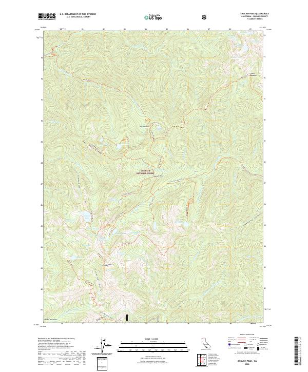
2022 Map of English Peak
USGS Topo · Published 2022About this map
English Peak and the high alpine terrain of the Klamath National Forest define this survey of northern California's wilderness. The landscape is a network of glacial basins containing numerous small lakes, including English Lake, Pine Lake, and Hancock Lake, which feed the headwaters of the North Fork Salmon River. This 2022 edition documents the intricate system of backcountry trails that provide the only access through the Marble Mountains, such as the English Peak Trl and the historic route of the Old Tanners Trl. The lack of road infrastructure, aside from the Little North Fork Road Trl, emphasizes the area's role as a protected primitive environment where geography is dictated by drainages like Snowslide Gulch and Sick Doe Gulch. Higher elevations are marked by the open stretches of Big Meadows and Grants Meadows, contrasting with the steep descent toward S Fork Wooley Cr.
Find a feature on this map
67 named features on this map. Tap any name to fly to it.
Don’t see what you’re looking for? This feature index may not catch every label — zoom into the map to look around manually.
Map Details
Editions of this 2022 English Peak Map
This is the sole edition of this map. No revisions or reprints were ever made.
Other maps of this area

1914 · Seiad
USGS Topo · 1:125,000

1922 · Seiad
USGS Topo · 1:125,000

1948 · Weed
USGS Topo · 1:250,000

1950 · Weed
USGS Topo · 1:250,000

1955 · Sawyers Bar
USGS Topo · 1:62,500

1955 · Ukonom Lake
USGS Topo · 1:62,500

1955 · Scott Bar
USGS Topo · 1:62,500

1955 · Forks of Salmon
USGS Topo · 1:62,500

1958 · Weed
USGS Topo · 1:250,000

1963 · Weed
USGS Topo · 1:250,000