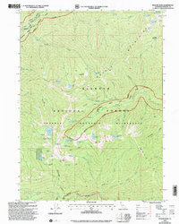
2001 Map of English Peak
USGS Topo · Published 2004About this map
English Peak stands as a central high point in this 2001 revision of the Klamath Mountains within the Marble Mountain Wilderness. The landscape is defined by its network of alpine lakes and remote backcountry sites, including Abbotts Cabin (Site) and the Tom Taylor Cabin. The topography reveals a complex drainage system where the North Fork Wooley Creek and Left Hand Fork Uncles Creek carve deep into the terrain. High-altitude meadows such as Grants Meadows and Big Meadows break up the ridges, while the Klamath Ridge separates prominent water bodies like Lake Katherine and Lake Ethel. This survey, updated by the Forest Service, documents the primitive trail networks like Tanners Trail that provide the only access through this part of the Klamath National Forest.
Find a feature on this map
65 named features on this map. Tap any name to fly to it.
Don’t see what you’re looking for? This feature index may not catch every label — zoom into the map to look around manually.
Map Details
Editions of this 2001 English Peak Map
This is the sole edition of this map. No revisions or reprints were ever made.
Other maps of this area

1914 · Seiad
USGS Topo · 1:125,000

1922 · Seiad
USGS Topo · 1:125,000

1948 · Weed
USGS Topo · 1:250,000

1950 · Weed
USGS Topo · 1:250,000

1955 · Sawyers Bar
USGS Topo · 1:62,500

1955 · Ukonom Lake
USGS Topo · 1:62,500

1955 · Scott Bar
USGS Topo · 1:62,500

1955 · Forks of Salmon
USGS Topo · 1:62,500

1958 · Weed
USGS Topo · 1:250,000

1963 · Weed
USGS Topo · 1:250,000