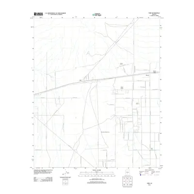
2011 Map of Enid
USGS Topo · Published 2011About this map
Waterman Wash carves through this desert landscape south of Goodyear, defining the drainage patterns of an area marked by both traditional ranching and modern aviation. The small settlement of Enid and nearby Heaton sit along the east-west rail line, serving as historic points of reference in a terrain characterized by the rising Palo Verde Mountains. The region’s development is signaled by an unusual density of private aviation facilities, ranging from the Estrella Sailport in the north to the Hidden Valley Airstrip, Millar Airport, and Boulais Ranch Airport. This distribution suggests a landscape where vast open spaces and favorable conditions supported a specialized airborne community alongside more traditional agricultural outposts like Wiley Ranch. The geometric grid of roads, such as W Kinney Rd and N Hidden Valley Rd, illustrates the systematic expansion of land use into the arid interior of Maricopa County.
Find a feature on this map
57 named features on this map. Tap any name to fly to it.
Don’t see what you’re looking for? This feature index may not catch every label — zoom into the map to look around manually.
Map Details
Editions of this 2011 Enid Map
This is the sole edition of this map. No revisions or reprints were ever made.
Other maps of this area

1913 · Maricopa
USGS Topo · 1:62,500

1915 · Maricopa
USGS Topo · 1:62,500

1946 · Antelope Peak
USGS Topo · 1:62,500

1948 · Antelope Peak
USGS Topo · 1:62,500

1951 · Estrella
USGS Topo · 1:62,500

1951 · Mobile
USGS Topo · 1:62,500

1952 · Maricopa
USGS Topo · 1:24,000
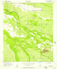
1952 · Pima Butte
USGS Topo · 1:24,000

1952 · Montezuma Peak
USGS Topo · 1:24,000

1952 · Enid
USGS Topo · 1:24,000