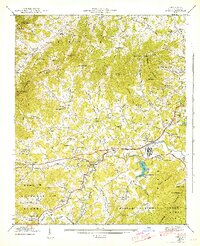
1942 Map of Enka
USGS Topo · Published 1942About this map
The industrial and agrarian landscape of western Buncombe County is centered on Enka Village and the massive facility near Enka Lake. Following the course of Hominy Creek, the Southern Railway serves as the economic spine of the region, connecting smaller communities like Candler Heights and Acton. The map reveals a high density of community landmarks, from the Pisgah Industrial Institute to numerous country churches like Zion Hill Ch and Snow Hill Ch, reflecting the social fabric of the 1940s.
Find a feature on this map
125 named features on this map. Tap any name to fly to it.
Don’t see what you’re looking for? This feature index may not catch every label — zoom into the map to look around manually.
Map Details
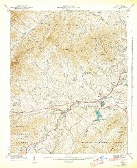
Editions of this 1942 Enka Map
2 editions found
Other maps of this area

1894 · Asheville
USGS Topo · 1:125,000

1901 · Asheville
USGS Topo · 1:125,000

1905 · Pisgah
USGS Topo · 1:125,000

1906 · Pisgah
USGS Topo · 1:125,000

1935 · Cruso
USGS Topo · 1:24,000

1935 · Canton
USGS Topo · 1:24,000

1936 · Sandymush
USGS Topo · 1:24,000

1936 · Enka
USGS Topo · 1:24,000

1936 · Weaverville
USGS Topo · 1:24,000

1936 · Skyland
USGS Topo · 1:24,000