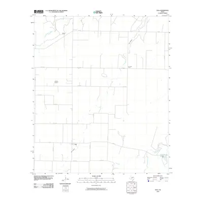
2010 Map of Eola
USGS Topo · Published 2010About this map
Eola serves as the primary settlement hub for this Concho County landscape, where the flat Texas terrain is defined by a grid of farm-to-market roads and seasonal drainage systems. The map shows the intersection of FM 381 and FM 765 at the heart of the village, providing a clear view of the rural infrastructure in the early 21st century. To the north, the Mereta Oil Field indicates the importance of energy extraction to the local economy, while landmarks like the Dry Hollow School and Lakeview Community Cemetery offer essential points of interest for genealogists tracing regional family history.
Find a feature on this map
26 named features on this map. Tap any name to fly to it.
Don’t see what you’re looking for? This feature index may not catch every label — zoom into the map to look around manually.
Map Details
Editions of this 2010 Eola Map
This is the sole edition of this map. No revisions or reprints were ever made.
Other maps of this area

1891 · Hayrick
USGS Topo · 1:125,000

1892 · San Angelo
USGS Topo · 1:125,000

1892 · Eden
USGS Topo · 1:125,000

1892 · Ballinger
USGS Topo · 1:125,000

1894 · Hayrick
USGS Topo · 1:125,000

1896 · Eden
USGS Topo · 1:125,000

1921 · Lowake
USGS Topo · 1:31,680

1932 · Paint Rock
USGS Topo · 1:62,500

1954 · Brownwood
USGS Topo · 1:250,000

1954 · San Angelo
USGS Topo · 1:250,000