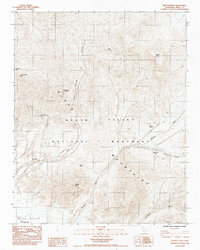
1984 Map of Epaulet Peak
USGS Topo · Published 1984About this map
Black Mountains dominate this 1984 survey, revealing a landscape defined by sharp elevations and seasonal watercourses within the Death Valley National Monument. The map documents a history of mineral exploration through isolated sites like the Desert Hound Mine and Graham Mine, situated near high points such as Epaulet Peak and Desert Hound Peak. These mining claims are connected by an intricate network of washes, including Rhodes Wash and Jubilee Wash, which serve as natural corridors through the varied terrain.
Find a feature on this map
25 named features on this map. Tap any name to fly to it.
Don’t see what you’re looking for? This feature index may not catch every label — zoom into the map to look around manually.
Map Details
Editions of this 1984 Epaulet Peak Map
This is the sole edition of this map. No revisions or reprints were ever made.
Other maps of this area

1908 · Furnace Creek
USGS Topo · 1:250,000

1910 · Furnace Creek
USGS Topo · 1:250,000

1933 · Avawatz Mountains
USGS Topo · 1:250,000

1940 · Eagle Tank
USGS Topo · 1:62,500

1947 · Trona
USGS Topo · 1:250,000

1948 · Trona
USGS Topo · 1:250,000

1948 · Death Valley
USGS Topo · 1:250,000

1950 · Confidence Hills
USGS Topo · 1:62,500

1951 · Funeral Peak
USGS Topo · 1:62,500

1951 · Eagle Mtn
USGS Topo · 1:62,500