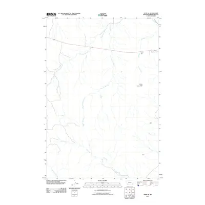
2011 Map of Epsie NE
USGS Topo · Published 2011About this map
The high plains of eastern Montana are defined here by a network of seasonal drainages including West Fork Wolf Creek and East Fork Wolf Creek. This 2011 survey of Powder River County reveals a landscape where water management and mineral extraction are the primary human imprints on the land. The Mathew James Number 1 Dam stands as a significant point of infrastructure in this arid environment, likely serving livestock in the expansive ranching country.
Find a feature on this map
13 named features on this map. Tap any name to fly to it.
Don’t see what you’re looking for? This feature index may not catch every label — zoom into the map to look around manually.
Map Details
Editions of this 2011 Epsie NE Map
This is the sole edition of this map. No revisions or reprints were ever made.
Other maps of this area

1954 · Ekalaka
USGS Topo · 1:250,000

1956 · Ekalaka
USGS Topo · 1:250,000

1958 · Ekalaka
USGS Topo · 1:250,000

1965 · Ekalaka
USGS Topo · 1:250,000
1973 · Olive
USGS Topo · 1:24,000
1973 · Lonesome Peak
USGS Topo · 1:24,000
1973 · Moonlight Creek
USGS Topo · 1:24,000
1973 · Yarger Butte
USGS Topo · 1:24,000
1973 · Eldon Mountain
USGS Topo · 1:24,000
1973 · Leslie Creek
USGS Topo · 1:24,000