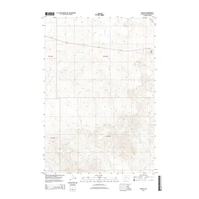
2014 Map of Epsie NE
USGS Topo · Published 2014About this map
The high plains of Powder River County are defined here by an intricate network of drainage systems feeding into the larger Wolf Creek basin. The convergence of the W Fork Wolf Cr and E Fork Wolf Cr illustrates the typical erosion patterns of the Montana landscape. A notable landmark in the northeast corner is Sand Creek Hill, which stands near the junction of Us-212 and MT-59, reflecting the vital transit corridors that have served this ranching region for decades.
Find a feature on this map
16 named features on this map. Tap any name to fly to it.
Don’t see what you’re looking for? This feature index may not catch every label — zoom into the map to look around manually.
Map Details
Editions of this 2014 Epsie NE Map
This is the sole edition of this map. No revisions or reprints were ever made.
Other maps of this area

1954 · Ekalaka
USGS Topo · 1:250,000

1956 · Ekalaka
USGS Topo · 1:250,000

1958 · Ekalaka
USGS Topo · 1:250,000

1965 · Ekalaka
USGS Topo · 1:250,000
1973 · Olive
USGS Topo · 1:24,000
1973 · Lonesome Peak
USGS Topo · 1:24,000
1973 · Moonlight Creek
USGS Topo · 1:24,000
1973 · Yarger Butte
USGS Topo · 1:24,000
1973 · Eldon Mountain
USGS Topo · 1:24,000
1973 · Leslie Creek
USGS Topo · 1:24,000