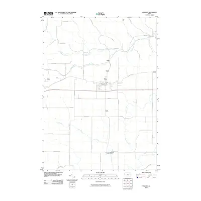
2010 Map of Epworth
USGS Topo · Published 2010About this map
Epworth serves as the central hub of this Dubuque County landscape, where the local community is anchored by the Epworth Post Office and several longstanding religious sites. The surrounding countryside is defined by the winding paths of the Little Maquoketa River to the north and Whitewater Creek to the southeast. Genealogists will find a high density of burial grounds throughout the quadrangle, including Saint Patricks Cemetery, Highview Cemetery, and the Saint Johns Catholic Placid Cemetery near the settlement of Pleasant Grove. The topography is marked by distinct drainages like Hogans Branch and Curran Branch, which cut through the agricultural sections. Smaller named locales such as Kidder and Lattnerville are connected by a network of rural routes, including the descriptively named Roller Coaster Rd, illustrating the undulating character of the Iowa terrain during the early 21st century.
Find a feature on this map
54 named features on this map. Tap any name to fly to it.
Don’t see what you’re looking for? This feature index may not catch every label — zoom into the map to look around manually.
Map Details
Editions of this 2010 Epworth Map
This is the sole edition of this map. No revisions or reprints were ever made.
Other maps of this area

1900 · Anamosa
USGS Topo · 1:125,000

1900 · Lancaster
USGS Topo · 1:125,000

1901 · Peosta
USGS Topo · 1:125,000

1902 · Elkader
USGS Topo · 1:125,000

1904 · Lancaster
USGS Topo · 1:125,000

1908 · Lancaster
USGS Topo · 1:125,000

1956 · Sherrill
USGS Topo · 1:24,000

1957 · Holy Cross
USGS Topo · 1:24,000

1959 · Dubuque
USGS Topo · 1:250,000

1961 · Dubuque
USGS Topo · 1:250,000