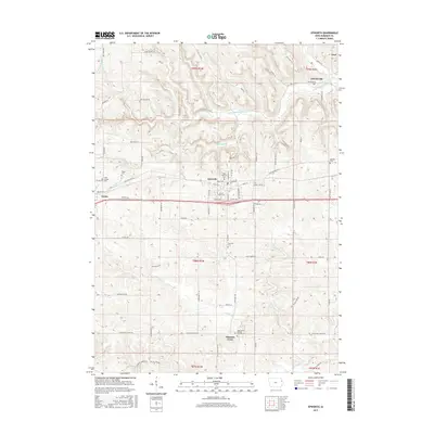
2015 Map of Epworth
USGS Topo · Published 2015About this map
Epworth and Farley anchor this Dubuque County landscape, where the rolling hills of northeast Iowa are carved by the Little Maquoketa River and Whitewater Cr. This modern survey documents a community deeply rooted in its religious and educational institutions, most notably the sprawling campus of Divine Word Coll and numerous parish grounds. The map reveals a dense network of local history through its many burial sites, including Saint Patricks Cem, Highview Cem, and Saint Johns Catholic Placid Cem near Pleasant Grove. Smaller hamlets like Graf and Lattnerville sit along the winding valley roads, while the surrounding countryside is defined by family-named landmarks and routes such as Leuchs Rd, Boge Rd, and Davidshofer Rd. The transition from historic township boundaries to modern transportation corridors like Old Highway Rd illustrates the evolving nature of this rural agricultural and spiritual hub.
Find a feature on this map
83 named features on this map. Tap any name to fly to it.
Don’t see what you’re looking for? This feature index may not catch every label — zoom into the map to look around manually.
Map Details
Editions of this 2015 Epworth Map
This is the sole edition of this map. No revisions or reprints were ever made.
Other maps of this area

1900 · Anamosa
USGS Topo · 1:125,000

1900 · Lancaster
USGS Topo · 1:125,000

1901 · Peosta
USGS Topo · 1:125,000

1902 · Elkader
USGS Topo · 1:125,000

1904 · Lancaster
USGS Topo · 1:125,000

1908 · Lancaster
USGS Topo · 1:125,000

1956 · Sherrill
USGS Topo · 1:24,000

1957 · Holy Cross
USGS Topo · 1:24,000

1959 · Dubuque
USGS Topo · 1:250,000

1961 · Dubuque
USGS Topo · 1:250,000