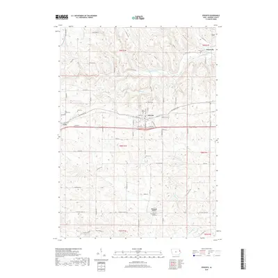
2018 Map of Epworth
USGS Topo · Published 2018About this map
Epworth and Farley anchor this portion of western Dubuque County, where the agricultural landscape is deeply carved by the Little Maquoketa River and Whitewater Cr. The settlement pattern reflects a strong parochial history, evidenced by numerous religious sites such as Saint Patricks Cem, Saint Josephs Cem, and Saint Johns Catholic. Smaller hamlets like Lattnerville, Graf, and Pleasant Grove remain distinct points on the map, connected by a network of rural roads that include Old Highway Rd and Freedom Rd. The topography reveals the intricate drainage of Hogans Br and Curran Br, which likely dictated early farmstead placement. Genealogists will find particular value in the dispersed burial grounds, including the Highview Cem, Johnson Cem, and Hogan Cem, which document the generations of families who settled these sections.
Find a feature on this map
80 named features on this map. Tap any name to fly to it.
Don’t see what you’re looking for? This feature index may not catch every label — zoom into the map to look around manually.
Map Details
Editions of this 2018 Epworth Map
This is the sole edition of this map. No revisions or reprints were ever made.
Other maps of this area

1900 · Anamosa
USGS Topo · 1:125,000

1900 · Lancaster
USGS Topo · 1:125,000

1901 · Peosta
USGS Topo · 1:125,000

1902 · Elkader
USGS Topo · 1:125,000

1904 · Lancaster
USGS Topo · 1:125,000

1908 · Lancaster
USGS Topo · 1:125,000

1956 · Sherrill
USGS Topo · 1:24,000

1957 · Holy Cross
USGS Topo · 1:24,000

1959 · Dubuque
USGS Topo · 1:250,000

1961 · Dubuque
USGS Topo · 1:250,000