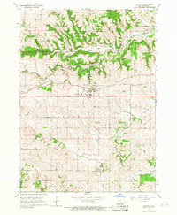
1966 Map of Epworth
USGS Topo · Published 1968About this map
Epworth serves as the focal point of this 1960s Dubuque County landscape, situated along the Illinois Central railroad. The town is marked by institutional landmarks including the Divine Word Seminary and the Western Dubuque Sch, while the surrounding rural landscape in Taylor and Vernon townships is defined by a series of family and community cemeteries such as St Josephs Cem, Epworth Cem, and Johnson Cem. North of the village, the Little Maquoketa River carves through the terrain near Lattnerville and Kidder, highlighting the intersection of water-carved geography and mid-century transport. The presence of several Quarries and Gravel Pits suggests an active local extraction industry supporting the region's road and rail infrastructure during this era of Iowa's development.
Find a feature on this map
34 named features on this map. Tap any name to fly to it.
Don’t see what you’re looking for? This feature index may not catch every label — zoom into the map to look around manually.
Map Details
Editions of this 1966 Epworth Map
This is the sole edition of this map. No revisions or reprints were ever made.
Other maps of this area

1900 · Anamosa
USGS Topo · 1:125,000

1900 · Lancaster
USGS Topo · 1:125,000

1901 · Peosta
USGS Topo · 1:125,000

1902 · Elkader
USGS Topo · 1:125,000

1904 · Lancaster
USGS Topo · 1:125,000

1908 · Lancaster
USGS Topo · 1:125,000

1956 · Sherrill
USGS Topo · 1:24,000

1957 · Holy Cross
USGS Topo · 1:24,000

1959 · Dubuque
USGS Topo · 1:250,000

1961 · Dubuque
USGS Topo · 1:250,000