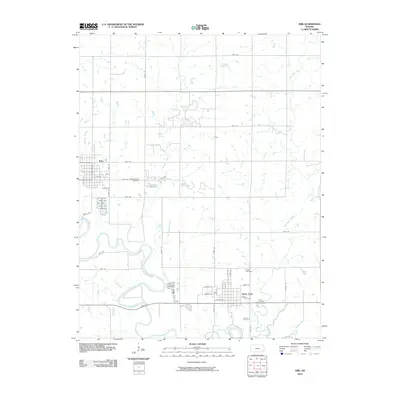
2010 Map of Erie
USGS Topo · Published 2010About this map
The Neosho River meanders across this Neosho County landscape, framing a rural environment defined by its tributary creeks and small agricultural hubs. The city of Erie occupies the western edge, showing a established grid system and significant local landmarks like the New East Hill Cemetery and East Hill Cemetery. To the southeast, Saint Paul sits near the river's path, its own street layout and the nearby Saint Francis Cemetery reflecting the community's historical development.
Find a feature on this map
44 named features on this map. Tap any name to fly to it.
Don’t see what you’re looking for? This feature index may not catch every label — zoom into the map to look around manually.
Map Details
Editions of this 2010 Erie Map
This is the sole edition of this map. No revisions or reprints were ever made.
Other maps of this area

1886 · Iola
USGS Topo · 1:125,000

1886 · Parsons
USGS Topo · 1:125,000

1893 · Iola
USGS Topo · 1:125,000

1893 · Parsons
USGS Topo · 1:125,000

1904 · Iola
USGS Topo · 1:125,000

1943 · McCune
USGS Topo · 1:62,500

1945 · Mc Cune
USGS Topo · 1:62,500

1945 · Parsons
USGS Topo · 1:62,500

1946 · Parsons
USGS Topo · 1:62,500

1947 · Parsons
USGS Topo · 1:62,500