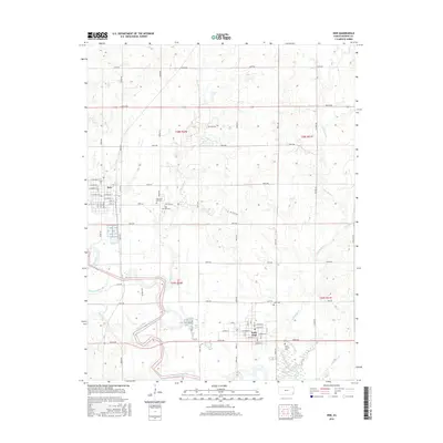
2016 Map of Erie
USGS Topo · Published 2016About this map
The Neosho River meanders through the heart of Neosho County, shaping a landscape defined by its fertile floodplains and a well-ordered grid of section roads. The city of Erie serves as a primary hub in the northwest, featuring a traditional town layout with streets like W State St and W Girard St. Further south, Saint Paul sits near the confluence of local waterways, including Flat Rock Cr and Broggan Cr. The map reveals a history of local industry and community planning through markers like Oil Field Rd and several significant burial grounds, such as New East Hill Cem and Saint Francis Cem. Smaller tributaries like Fourmile Cr and Ogeese Cr weave between the section lines, highlighting the agricultural and drainage patterns of this eastern Kansas prairie region.
Find a feature on this map
59 named features on this map. Tap any name to fly to it.
Don’t see what you’re looking for? This feature index may not catch every label — zoom into the map to look around manually.
Map Details
Editions of this 2016 Erie Map
This is the sole edition of this map. No revisions or reprints were ever made.
Other maps of this area

1886 · Iola
USGS Topo · 1:125,000

1886 · Parsons
USGS Topo · 1:125,000

1893 · Iola
USGS Topo · 1:125,000

1893 · Parsons
USGS Topo · 1:125,000

1904 · Iola
USGS Topo · 1:125,000

1943 · McCune
USGS Topo · 1:62,500

1945 · Mc Cune
USGS Topo · 1:62,500

1945 · Parsons
USGS Topo · 1:62,500

1946 · Parsons
USGS Topo · 1:62,500

1947 · Parsons
USGS Topo · 1:62,500